Oregon Land and Maps
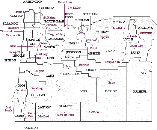
Oregon Map with County Seats
Maps
Oregon Map with Counties - Present
Washington Counties in Oregon Territory
Animated Migration Map showing settlement of the US
Boundaries of the US and Several States
County Search - Enter the city and find which county they are in.
Oregon County Seats and Geography
Land Records
County Records - Oregon State Archives
Provisional and Territorial Records - Oregon State Archives
State Records - Oregon State Archives
Federal Records - Oregon State Archives
BLM, GLO Records
We provide live access to Federal land conveyance
records for the Public Land States. We also provide image access to more
than two million Federal land title records for Eastern Public Land States,
issued between 1820 and 1908. Images of Serial patents (land titles
issued between 1908 and the mid-1960's) are currently being added to this
web site. Due to organization of documents in the GLO collection, this site
does not currently contain every Federal title record issued for the Public
Land States.
Oregon Native American Land Patents
- Oregon Siletz Land Patents: A-J
- Oregon Siletz Land Patents: J-Z
- Oregon Umitilla Land Patents
- Oregon Warm Springs Land Patents